For as long as Indigenous People have been defending themselves from the encroachment of modern civilization, there has been a steady debate regarding the so-called need for indigenous people to modernize themselves, “lest perish by the sheer weight of their own irrelevance.”
We can talk more about this another day. For now here are a couple recent stories about how technology, specifically satellite imaging, is being used to assist indigenous people… (I am actually hearing about the utilization of satellite technology for this ends. See my post Protecting Shipibo Territory for another example.)
While in the San Fransisco area last month, Chief Almir Surui of the Surui People paid a visit to Google, asking them for help in obtaining high-quality satellite imagery so his people can “monitor loggers and miners, who have no legal right to operate on the tribe’s 600,000-acre reserve about 1,600 miles northwest of Rio de Janeiro.”
Receptive to this, Google said OK. And now they’re working on a plan to let the Surui use Google’s technology. (source)
Sadly, on the other side of the world, Tribes in Southeast Asia are being prevented from using the same technology to help them win their own land rights…
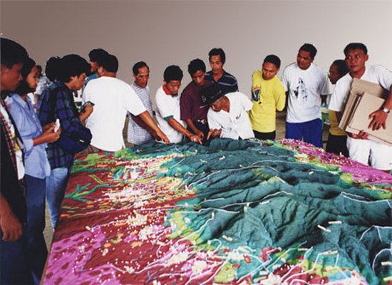
Commonly referred to ‘participatory GIS’, lawmakers in the Philippines are changing existing laws so only “officially recognized engineers “could do anything related to measuring space.”” Violation of this law carries with it fines, and possibly jail time for up to three years…
“In nearby Malaysia, the indigenous community Rumah Nor used high-tech mapping techniques to win a landmark court case in 2001 against a major paper company that was encroaching on its territory.” (source)
Finally, for the people of Darfur, the American Association for the Advancement of Science (AAAS) and Amnesty International recently teamed up to monitor the Darfur conflict by Satellite: “High-resolution commercial satellite images, analyzed by AAAS researchers, are posted after to Amnesty International’s new “Eyes on Darfur” Web site. The project is at the forefront of efforts by human rights groups to use satellite cameras to help protect vulnerable populations. It will allow computer users around the globe to visually track the status of settlements Amnesty International considers possible targets of attack.” (source)

Indigenous Peoples are putting their bodies on the line and it's our responsibility to make sure you know why. That takes time, expertise and resources - and we're up against a constant tide of misinformation and distorted coverage. By supporting IC you're empowering the kind of journalism we need, at the moment we need it most.